The Mere Bank
Bringing the Mere Bank into better condition.
Preserving the past
Expanding the water recycling centre at Avonmouth will help the city of Bristol meet the challenges of the future, but we are also determined to safeguard the past.
Close to our site near Kings Weston Lane in Avonmouth is the Mere Bank Scheduled Monument, a medieval flood defence which is included on the National Heritage List for England and a rare feature both nationally and within the Avon and North Somerset Levels.
About the Mere Bank
A rare feature both nationally and within the Avon and North Somerset Levels, the 1.15 km Mere Bank lies within Avonmouth’s industrial area, to the north-west of the M5 motorway and its flanking ditches are thought to have Roman origins, although the present Mere Bank likely relates to 12th or 13th century attempts to protect an area of land from sea and river flooding.
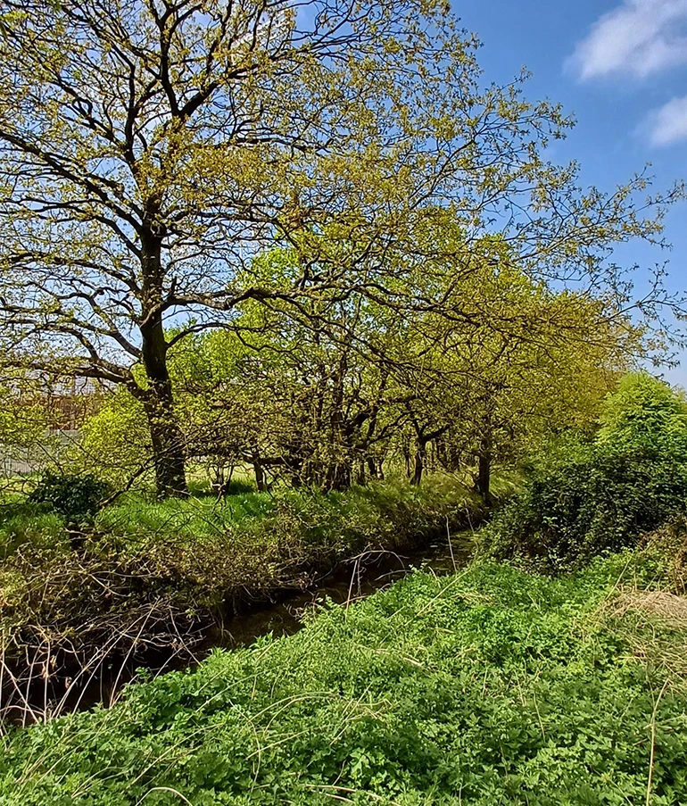
Public rights of way run parallel to a section of the Mere Bank before crossing it and again running parallel on the other side.
The monument comprises a low bank with two flanking ditches. The ditch on the northeastern side of the bank, the Mere Bank Rhine, measures between one and three metres wide. To the south west, the bank is flanked by a narrower field ditch boundary.
The bank itself is three to five metres wide and the whole monument is approximately nine metres in width.
Previous excavation revealed the bank to have been constructed of a series of layers of clay loam and silty clay, below which lie regular silt deposits from flooding.
Pottery from the 12th-13th centuries has previously been found beneath the bank, which was a barrier to reclaim part of the wetlands of the Avon levels and saw increased industrial development in the 19th century.
How can we help?
As part of our water recycling centre extension plans, we want to bring the Mere Bank into better condition and improve public access to it and will be seeking permission from Historic England to do so.
We'll follow a Heritage Management Plan, which has also been written to benefit the protected species that use these ditches.
This plan includes:
- selective coppicing (trimming back trees or shrubs to allow them to regenerate), which will reduce future risk to the stability of the monument and its underlying archaeology
- controlling vegetation within the area by cutting back – but not removing the roots
- protecting the area during water recycling centre operations
- litter picking
- enhancing understanding of the local archaeology, including through updates such as this
- a 15-metre-wide environmental corridor that would also be retained between Mere Bank and the proposed extension to help to protect it.
What else are we proposing to do?
We have already completed archaeological fieldwork across the proposed development field, which included taking borehole samples to establish historical land use in the area.
This fieldwork indicated that prior to the building of the Mere Bank, the site would have been within the subtidal realm, supporting the likelihood that it was built to try and protect an area of land from sea inundation.
Further work is needed on the bank itself to understand its formation in greater detail.
Later in 2025, additional archaeological fieldwork, including taking monolith samples within an existing trench across the Mere Bank, will take place, with the potential for these samples to be further analysed to help archaeologists understand more about the formation of the Mere Bank.
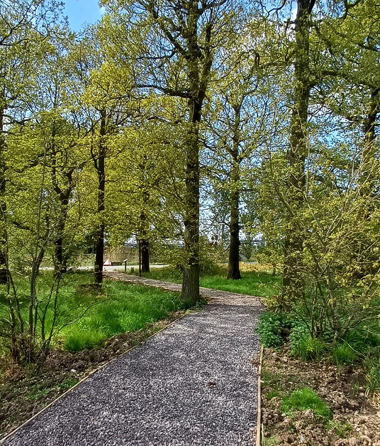
Our revitalised footpaths adjacent to the water recycling centre, include a new diverted footpath joining the existing right of way network, allowing for a safer, more pleasant and accessible route to view the Scheduled Monument, and the newly established ditch next to the site, which provides a habitat for reed bunting birds.